The 18th century building shown here was known as the Richards Tavern or Richards Hotel. It stood on Heath Street (foreground) near the intersection with Hammond Street, approximately where 521 Heath Street is today.
(Note: This article first appeared in Brookline Patch as part of a biweekly series of historical images of Brookline from the Brookline Historical Society and the Public Library of Brookline.)
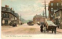
 |
| View larger size image |
It was built sometime between 1750 and 1770 — sources vary — by Ebenezer Winchester, a member of the religious splinter group called the “New Lights,” one of many groups that arose as part of the religious revival known as The Great Awakening. In addition to serving as the Winchester home, it included a large hall for meetings of Winchester’s co-religionists.
The house passed through two other owners before being sold to Ebenezer Richards who operated it as a tavern and hotel until about 1830. The Worcester Turnpike (now Route 9) which opened in 1806 passed just to the rear of the tavern. A toll gate and a toll house for the gatekeeper were placed at that spot on the Turnpike which no doubt contributed to the success of the tavern (It became something like an early 18th century version of a modern highway rest stop.)
The former tavern was acquired by Irish immigrant William Fegan in 1863. Fegan operated it as a boarding house. Harriet Woods in her Historical Sketches of Brookline (1874) described it as “now occupied by many Irish tenants.” Fegan died in 1911 at the age of 87. The house, deteriorating in condition (as seen in the 1927 photos below), remained in the Fegan family until it was torn down in 1928.
 | |||
| View zoomable larger size image |

The map below, adapted from a segment of the 1927 Brookline atlas, shows the former Richards Tavern (highlighted by the red rectangle and with the name J.J. Fegan) on Heath Street near the corner of Hammond Street. Boylston Street (Route 9) runs from the top edge to the right edge. The Baldwin School is at lower right and part of Holyhood Cemetery is at lower left.
 |
| Click image for larger view |
No comments:
Post a Comment